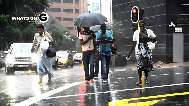
South Africa braces for cloudy, cool, and stormy conditions on Monday, 20 October, as unstable air systems sweep across several provinces. While some regions can look forward to calm, mild weather, others face a day of thunderstorms, strong winds, and possible flooding, according to the South African Weather Service (SAWS).
This shift signals the early signs of summer rain patterns, as humid tropical air and incoming cold fronts interact — particularly across the central and northern provinces.
ALSO READ: Panyaza Lesufi Sets 2029 Goals: 95% Potholes Fixed in 72 Hours, Traffic Lights Working
Severe Weather Warnings Are in Effect
The SAWS has issued a level two yellow warning for severe thunderstorms over the western and central North West, the far north-eastern Northern Cape, and the north-western Free State.
These storms are expected to bring heavy rainfall, gusty winds, and hail, which could trigger flash floods, road closures, and property damage.
Residents in low-lying or flood-prone areas are urged to stay alert and take precautions. “We’re calling on the public to avoid flooded roads and be cautious when traveling, as poor visibility and slippery surfaces can cause accidents,” SAWS advised.
A level four yellow alert remains in effect for the western North West, where continuous heavy rain may intensify flooding risks and lead to crop and infrastructure damage, particularly in rural areas.
Provincial Forecast: Here’s What to Expect
Gauteng
Gauteng will experience a cloudy and cool start to the week, with scattered showers and thunderstorms likely throughout the afternoon. Temperatures will stay mild, and the risk of sunburn is low.
Commuters should prepare for wet roads and slower traffic during the morning and evening peak hours, especially around Pretoria and Johannesburg, where localized showers are expected to linger.
Mpumalanga
Expect cold, overcast skies across most of Mpumalanga. Thunderstorms and scattered showers will develop over the escarpment and Highveld areas, while the Lowveld will have isolated rain and slightly warmer conditions.
Limpopo
The province will be cool to mild, with isolated thunderstorms expected in the south-west. The Lowveld may see light, patchy rain later in the day.
Drivers heading through Polokwane or Thabazimbi should anticipate wet and slippery roads.
North West
North West will see partly cloudy to cloudy skies, with scattered thunderstorms across most areas.
The north-western region around Mahikeng and Vryburg will be warmer with isolated showers.
Given the active weather warnings, residents are encouraged to stay indoors during storm activity and secure outdoor items.
Free State
Sunny and warm weather will dominate the south-west, while the north and east can expect cooler, stormy conditions.
Scattered thunderstorms could bring sudden downpours, especially near Welkom and Harrismith.
Farmers are advised to monitor conditions closely, as heavy rain could affect early planting and crop management.
Northern Cape
Morning mist and fog patches are expected in the southern interior, giving way to warm to hot conditions in the west.
The north-east will experience scattered thunderstorms, accompanied by moderate to fresh south-easterly winds that will strengthen by afternoon.
Strong gusts and blowing sand are possible along the coast near Alexander Bay.
Western Cape
The Western Cape will enjoy mostly fine, warm conditions, except for morning fog over the Karoo.
It will be hot and dry along the west coast, with cooler temperatures along the south coast.
Strong south-easterly winds will raise the risk of veld fires inland.
The UV index remains very high, so residents are advised to apply sunscreen and stay hydrated.
Eastern Cape (western half)
The western half of the province will be cloudy and cool, warming slightly inland towards Graaff-Reinet.
Coastal winds will be moderate to fresh from the east, while dry conditions are expected in most interior areas.
Eastern Cape (eastern half)
Cloudy skies and light showers are forecast along the coastline, especially between East London and Port St Johns.
Inland regions will experience a mix of cloud and sunshine, with moderate north-easterly winds throughout the day.
KwaZulu-Natal (KZN)
KZN will start with fog patches over the interior, clearing to cloudy and cool-to-cold conditions.
Showers and thunderstorms are expected later in the day, particularly over the southern and central parts.
Coastal winds will shift from easterly to south-easterly, turning north-easterly by evening.
Sunburn risk remains moderate due to limited sunshine hours.
Outlook: A Wet Week Ahead?
Meteorologists warn that rain and thunderstorms may persist throughout the week, with more widespread rainfall expected from Tuesday into Wednesday.
The unstable weather pattern is linked to moist tropical air moving southwards, a clear sign of the developing La Niña system, which typically brings above-average rainfall to southern Africa.
Residents are encouraged to monitor daily SAWS forecasts, keep emergency supplies ready, and stay clear of flooded low-water bridges and streams.


