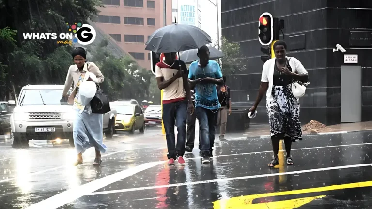
South Africa is bracing for a turbulent weekend as the South African Weather Service (SAWS) warns of severe thunderstorms, heavy rain, and hail sweeping across the country on Saturday, 18 October 2025. Most provinces are set for stormy conditions, with the Free State, North West, KwaZulu-Natal, and Northern Cape expected to bear the brunt. Only the Western Cape will be spared, enjoying calmer skies.
Thank you for reading this post, don't forget to subscribe!This comes after a week of unpredictable spring weather. Gauteng residents have already endured scattered showers and bursts of lightning since midweek. The latest alert from SAWS calls on residents to stay alert and prepare for possible flooding, especially in low-lying and vulnerable areas.
ALSO READ: Weekend Gig Guide: What To Do in Gauteng This Weekend (17-19 October 2025)
Yellow Level Warnings Across Multiple Provinces
SAWS has placed a Level 2 yellow warning on several provinces, highlighting the risk of severe thunderstorms in the Free State, western North West, KwaZulu-Natal, and north-eastern Northern Cape. These systems are expected to bring damaging winds, intense downpours, and hailstones that could harm crops, vehicles, and property.
“The combination of strong winds and hail can lead to localized flooding, uprooted trees, and road blockages,” warned SAWS forecaster Nkosinathi Dlamini. “We’re urging residents to take cover, secure outdoor items, and avoid unnecessary travel during the storms.”
Motorists should drive slowly, keep headlights on during rain, and avoid flooded roads and bridges.
Along the KwaZulu-Natal coast, SAWS has issued a Level 1 yellow warning for damaging coastal winds between Port Edward and Durban.
In the Eastern Cape, Walter Sisulu Local Municipality remains under a fire danger warning, with extremely dry and windy conditions persisting despite sporadic showers.
Weather Forecast by Province – Saturday, 18 October 2025
Gauteng
Expect a cloudy, cool-to-warm Saturday with scattered thundershowers developing from late morning. Storms will intensify through the afternoon, bringing bursts of hail and lightning across Johannesburg, Pretoria, and the Vaal Triangle. The UVB index will be very high, so sunscreen and shaded areas are essential between 10 am and 3 pm.
Mpumalanga
The Lowveld will start partly cloudy, while the Highveld and southern districts will see scattered thundershowers. Temperatures will rise through midday, and thunderstorms could spread to Ermelo and Carolina later in the day.
Limpopo
The province will experience hot and partly cloudy weather, with isolated thunderstorms forming over Lephalale and Modimolle in the southwest. The rest of the region will stay dry but humid, especially during the late afternoon.
North West
Residents can expect warm, cloudy skies and scattered thundershowers. Isolated hailstorms are likely around Rustenburg and Vryburg. Residents should secure outdoor items and avoid open fields during lightning strikes.
Free State
Cloudy and warm conditions will dominate, with widespread thundershowers and occasional lightning across the province. Heavy rain could hit the northern and central areas, while Trompsburg in the southwest may stay dry.
Northern Cape
A hot, partly cloudy day lies ahead, with isolated thunderstorms expected over the eastern districts such as Kimberley. The western interior, including Upington, will remain hot and dry.
Western Cape
The Western Cape will enjoy mostly fine weather in the northeast, turning partly cloudy and warm elsewhere. Along the south coast — from Mossel Bay to Plettenberg Bay — isolated showers are expected. The UVB index will be extremely high, so residents should take precautions against sunburn.
Eastern Cape
- Western half: Cloudy and windy along the coast with scattered showers. Inland towns like Graaff-Reinet will experience occasional thunder and warm daytime highs.
- Eastern half: Windy and cloudy with scattered thundershowers across the north and east.
KwaZulu-Natal
A cloudy and cool-to-warm day is expected, with scattered thunderstorms across most districts. Coastal areas such as Durban and Richards Bay could experience short, intense rain bursts, while inland regions like Pietermaritzburg may face lightning and strong winds.
Storm Safety Guidelines
- Stay indoors during thunderstorms and avoid open fields, trees, or metal structures.
- Unplug electronics to protect them from lightning surges.
- Don’t attempt to cross flooded roads or low bridges.
- Bring pets and livestock indoors during hail or lightning.
- Avoid going out to sea or using small boats when wind warnings are in effect.
Outlook for Sunday and the Week Ahead
SAWS expects weather conditions to ease by Sunday afternoon, with rainfall tapering off across most inland provinces. However, isolated thundershowers may continue in the north-eastern regions into early next week.
Communities are encouraged to stay updated through the official SAWS channels and to prepare for sudden weather changes as the rainy season gains momentum. Stay alert, stay safe, and plan your weekend wisely. For ongoing weather and events coverage in Gauteng, visit SAWS.


