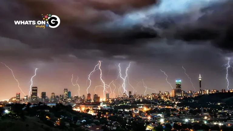
The South African Weather Service (SAWS) has issued an alert for severe thunderstorms expected to hit parts of Limpopo and Mpumalanga on Saturday, 11 October 2025.
A weather system moving across the northeastern interior will bring heavy rain, hail, strong winds, and a high risk of localized flooding.
At the same time, several inland provinces — including the Northern Cape, North West, Free State, and Eastern Cape — face extreme fire danger conditions due to dry and windy weather, prompting SAWS to urge residents to exercise caution with any outdoor burning or agricultural activity.
ALSO READ: Tembisa Hospital “Prayer Day” Event: Gauteng Premier’s Office Sets the Record Straight
Level 2 Warning for Severe Thunderstorms
SAWS has issued a Level 2 impact-based warning for the central and western parts of Limpopo and southern Mpumalanga, where severe thunderstorms are likely to develop during the afternoon and evening.
These storms could bring intense downpours, hail, and damaging winds, posing risks of flash flooding and storm damage in vulnerable areas. Motorists are urged to slow down and avoid crossing flooded roads, while communities should secure outdoor furniture, signage, and loose items ahead of the storm.
High Fire Danger Across Inland Provinces
The weather service has also cautioned that fire danger levels remain critical across:
- Central and eastern Northern Cape
- Western Free State
- Western North West
- Interior and Western Cape
Under these conditions, fires can spread rapidly and become difficult to contain. Residents are strongly advised not to start fires and to report fire outbreaks to local emergency authorities immediately.
National Weather Overview
A mix of moist tropical air and a surface trough across the interior will trigger thunderstorms over the eastern half of the country, while coastal regions remain cool and cloudy. The interior will see warm to hot conditions with scattered afternoon showers.
Here’s a detailed provincial outlook for Saturday, 11 October 2025:
Gauteng
Cloudy skies in the morning, turning partly cloudy and warm later. Isolated thundershowers over Pretoria, Hammanskraal, and the northern regions.
Mpumalanga
Morning fog patches will clear to a partly cloudy and cool to warm day. Scattered thunderstorms are likely across the central and western parts, including Middelburg, Ermelo, and Belfast, where heavy rain may cause localized flooding.
Limpopo
Expect fog and cloud cover early in the morning, clearing to partly cloudy skies. Thunderstorms are expected in the central and western districts, such as Polokwane, Makhado, and Lephalale, while the Limpopo Valley remains mostly dry.
North West
A partly cloudy and hot day is expected, with isolated afternoon showers in the eastern districts, including Rustenburg and Brits.
Free State
A fine and warm morning will give way to partly cloudy conditions by afternoon, with isolated thundershowers developing in the central and eastern areas.
Northern Cape
Morning fog is likely along the coast, clearing to hot and dry conditions inland. Isolated thundershowers could develop in the central and eastern interior, where fire danger remains a key concern.
Western Cape
Fog patches in the Overberg and Breede Valley will clear to partly cloudy and warm weather. The south coast, from Mossel Bay to Plettenberg Bay, may see light afternoon rain, while the interior stays warm and dry.
Eastern Cape (Western Half)
Cloudy in the morning with fog patches along the southern parts, becoming partly cloudy and hot, with light coastal rain developing in the afternoon.
Eastern Cape (Eastern Half)
Fine and hot conditions for most of the day, becoming partly cloudy later.
KwaZulu-Natal
Fog patches in the morning will clear to a partly cloudy and hot day, with isolated thundershowers in the northwestern districts such as Newcastle and Dundee before clearing in the evening.
UVB Sunburn Index: Very High
The UVB sunburn index remains very high across South Africa.
Residents are advised to:
- Use sunscreen (SPF 30+) regularly
- Wear hats and UV-protective clothing
- Avoid direct sunlight between 10:00 and 15:00
Stay Weather-Wise
With thunderstorms, heat, and fire risks affecting multiple provinces, SAWS has urged South Africans to stay alert and follow local forecasts.
Communities in flood-prone or fire-sensitive zones should prepare accordingly and avoid unnecessary travel during storm activity.
For live weather alerts and detailed forecasts, visit the South African Weather Service for verified updates and safety information.


