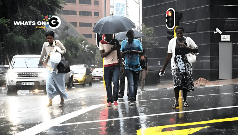
The South African Weather Service (SAWS) has issued a yellow level 2 warning for severe thunderstorms set to sweep across most of the country on Tuesday, 28 October 2025. The storms will hammer inland provinces with heavy rain, hail, and strong winds, sparing only the Western, Eastern, and Northern Cape coastal regions.
Thank you for reading this post, don't forget to subscribe!Gauteng, Free State, North West, Limpopo, Mpumalanga, and KwaZulu-Natal residents have been told to stay on high alert as storm clouds build early in the morning. The weather system will roll across the central interior, unleashing downpours, strong winds, and hail that could damage property, vehicles, and crops.
ALSO READ: Load Reduction Alert: Gauteng Suburbs Facing Scheduled Power Cuts This Week (27–31 October 2025)
Warnings For Tuesday, 28 October
Impact-Based Warning
SAWS warns that thunderstorms could flood roads, bridges, and informal settlements in central Limpopo, western North West, northern and central Free State, southern Gauteng and Mpumalanga, and northwestern KwaZulu-Natal.
Gusty winds may rip off roofing sheets or topple small structures, while hail could dent cars and destroy crops. Residents should secure outdoor items, avoid open areas when lightning strikes, and slow down on rain-soaked roads.
Fire Danger Warning
In the Northern Cape, extreme fire conditions threaten the Kamiesberg Local Municipality. Hot, dry air and strong winds could spark veld fires that spread quickly. Authorities urge residents to put off lighting fires or doing outdoor burns until conditions improve.
What To Expect Across The Country
Gauteng
Expect a partly sunny, hot day with thundershowers developing by afternoon. Storms will be more scattered in the south, including Johannesburg and Vereeniging.
UVB Sunburn Index: Very High – wear sunscreen and avoid extended sun exposure.
Mpumalanga
Partly cloudy skies will cover the Highveld, while the Lowveld heats up under humid conditions. Thunderstorms will develop through the afternoon and become scattered in the far southeast.
Limpopo
Morning clouds will clear to a hot, partly cloudy afternoon. Thunderstorms will spread across the central districts, including Polokwane and Mokopane.
North West
Hot and partly cloudy conditions will dominate, with storms expected to flare up in the west and central regions. Rustenburg and Mahikeng could see brief but intense rain and thunder.
Free State
Warm to hot conditions will prevail. Scattered thundershowers will move across the central and eastern regions, including Bloemfontein, while the west stays dry and breezy.
Northern Cape
Fine and dry conditions will cover most areas, but isolated thundershowers may develop in the northeast later in the day. Temperatures will remain high, with moderate to fresh winds.
Fire Danger: Extremely High in Kamiesberg.
Western Cape
Morning clouds will linger over the southwest coast, clearing to a fine and warm afternoon. The same cloud cover will return along the south coast in the evening.
UVB Sunburn Index: Very High: limit outdoor activities and apply sunscreen regularly.
Eastern Cape (Western Half)
Fine and hot inland, but cool along the coast. Winds will increase slightly later in the day.
Eastern Cape (Eastern Half)
Partly cloudy and warm conditions will persist along the Wild Coast and nearby inland areas. Coastal regions will stay cool throughout the day.
KwaZulu-Natal
Partly cloudy skies will cover most of the province. Expect scattered thundershowers, more frequent in the northwest. Durban, Pietermaritzburg, and Newcastle may experience heavy rain, lightning, and gusty winds.
What This Means For Residents
This storm warning comes just a day after heavy downpours drenched much of the country. Many areas remain waterlogged, which means even moderate rain could lead to flash floods. The unstable conditions also increase the risk of power outages and road accidents.
Disaster management teams in Gauteng, Limpopo, and KwaZulu-Natal are on standby to assist communities. Drivers should keep headlights on, reduce speed, and steer clear of flooded crossings. Residents living near rivers or in flood-prone areas should move valuables to higher ground and keep emergency numbers close.
Safety Tips During Thunderstorms
- Stay indoors when thunderclouds gather.
- Unplug appliances to avoid power surges.
- Keep pets and livestock under shelter.
- Avoid using electrical equipment during lightning.
- Never drive through flooded roads or bridges.
Looking Ahead
SAWS expects thunderstorms to linger into Wednesday, with more showers expected over the Highveld and southern KwaZulu-Natal. Cooler air will move into the central interior later in the week as the system weakens.
South Africa’s spring storms often arrive suddenly and with force. Residents should stay alert, follow weather updates, and prepare for rapidly changing conditions as the country’s storm season continues to unfold.


