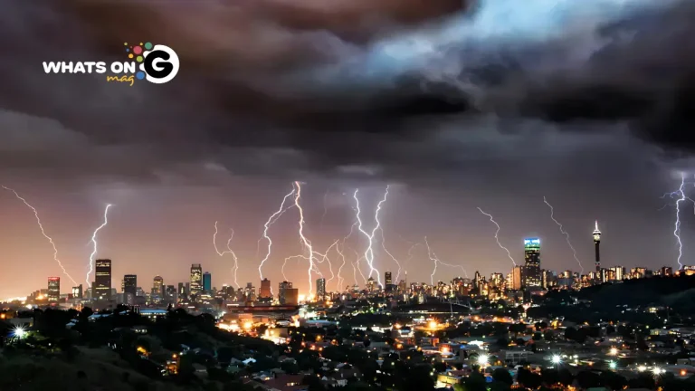
Level 4 Warning Issued For Severe Thunderstorms
The South African Weather Service (SAWS) has sounded the alarm for severe thunderstorms expected to pound several parts of the country on Monday, 27 October 2025. The strongest storms will hit Mpumalanga, Limpopo, and northern KwaZulu-Natal, where residents should brace for flooding, hail, and strong winds that could upend normal routines.
Thank you for reading this post, don't forget to subscribe!Storm systems are already building over the interior, driven by hot, moisture-heavy air and unstable atmospheric conditions. SAWS warns that these systems will unleash lightning, heavy rain, and localised flooding as they move eastward. Most provinces will see isolated thundershowers, sudden temperature drops, and shifting weather patterns throughout the day.
ALSO READ: Panyaza Lesufi Leads Gauteng’s Tswa Daar Drive to End Substance Abuse
Widespread Rainfall Expected Across The Country
Meteorologists are warning that flash floods could hit low-lying areas, especially near rivers, informal settlements, and urban areas with poor drainage. SAWS spokesperson Lerato Mahlangu said the mix of heat, humidity and surface moisture is intensifying convection and storm build-up. She urged motorists to stay alert, slow down on slippery roads, and avoid crossing flooded bridges.
Along with torrential rain, hail and powerful gusts could lash parts of Limpopo and Mpumalanga’s escarpment. Residents are being urged to secure loose objects and stay indoors during lightning storms.
In contrast, Limpopo’s Lephalale Local Municipality faces an opposite threat. SAWS has issued a fire danger alert for the area, where dry, gusty winds and high temperatures could spark runaway veld fires. Locals have been urged to avoid open flames and outdoor burning.
What To Expect In Each Province
Gauteng:
Cloudy skies and cool to warm conditions will dominate. Expect isolated thundershowers that become more widespread in the northeast. Afternoon lightning could affect travel in Johannesburg and Pretoria, so commuters should plan for possible traffic delays.
UVB Index: High – use sunscreen, even under cloud cover.
Mpumalanga:
Expect cloudy and warm conditions with morning fog patches along the escarpment. Scattered to widespread thundershowers will sweep across the Highveld, while Lowveld towns like Nelspruit and Komatipoort will swelter in humid heat that fuels late-afternoon storms.
Limpopo:
Partly cloudy and hot, with extreme heat in the Lowveld and scattered thunderstorms across most districts. Polokwane, Mokopane, and Thohoyandou could face intense lightning and short, heavy bursts of rain.
Fire Danger: Extreme in and around Lephalale.
North West:
Expect very hot conditions with isolated thundershowers, especially near Rustenburg and Brits. Southern parts of the province will stay dry and windy.
Free State:
Cool to warm conditions with scattered thundershowers in the central and eastern parts. The west will remain clear and dry.
Northern Cape:
Fine and cool to warm, turning cold over the southern interior. Coastal winds will strengthen from southerly to south-easterly directions by afternoon.
Western Cape:
Morning cloud cover will clear by midday, leaving fine and cool conditions across most regions. The eastern interior, including the Karoo, will be warmer. Coastal winds will pick up along the south coast later in the day.
UVB Index: Very High – beachgoers and outdoor workers should take extra care.
Eastern Cape (Western Half):
Overcast and cool in the morning, clearing to fine and mild conditions by noon. Fresh south-westerly winds will ease later in the afternoon.
Eastern Cape (Eastern Half):
Cloudy with scattered rain and showers, especially along the Wild Coast. Moderate to fresh south-westerly winds will maintain a cool temperature throughout the day.
KwaZulu-Natal:
Expect cold to cool conditions with morning fog over the southern interior. Scattered thundershowers will roll through the province, while northern districts face heavy downpours and hail. Durban and nearby coastal regions will be humid and unsettled, with winds turning southerly by late afternoon.
UVB Index: High.
Why This Matters
The warnings come as South Africa transitions from a scorching spring into a volatile storm season. After weeks of intense heat, this weather shift shows how quickly conditions can change during late October.
Farmers welcome the rain as relief for parched crops, but disaster management teams are on alert for potential flooding in vulnerable communities. Residents are encouraged to follow official weather alerts, listen to local radio updates, and keep emergency kits ready in case of power outages or road closures.
Safety Tips For Residents
- Never drive through flooded roads or low-lying bridges.
- Unplug electrical appliances when lightning approaches.
- Keep pets and livestock sheltered during hailstorms.
- Stay indoors when thunderclouds gather overhead.
Looking Ahead
SAWS expects unstable weather to continue into midweek, with more showers possible over the Highveld and KwaZulu-Natal by Wednesday. Conditions should stabilise by the weekend, but short-lived morning and afternoon thundershowers may continue.
South Africa’s spring storms are known for their unpredictability. They bring much-needed rain, but also dangerous conditions. Staying informed, alert and cautious will help households and communities weather the week ahead safely.


